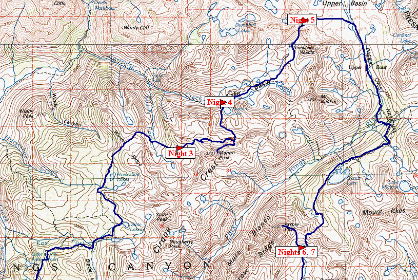
Sierra Trip 90 -- Marion and Arrow Peaks
You can download the TOPO! source file to see
more detail in the maps.
The complete set of raw photos is here.
I had never before been north of Cedar Grove in Kings Canyon. This trip was
planned with an eye to exploring some of this territory.
One of the advantages of flying west is that the time change works in your favor.
I have always thought it remarkable that I could leave home in New Jersey in the
morning, fly to Fresno, and get up into SEKI the same afternoon. This time I aimed
to beat that -- if everything worked as planned I could get my wilderness permit that
afternoon and hike in to the first camp area the same day. I had been through the
drill enough times that I know where to get fuel, how long it would take to get to the
park, and so forth. Although the plane was delayed a little bit, and there was some
more delay in getting the rental car, I drove like a madman and got to the ranger station
10 minutes before closing time, and picked up my permit.
 |
The hike up Copper Creek was memorably hot, even though I started at 5:00 PM.
I always have such incredible energy the first day -- good to make use of it. The
trail climbs from 5000 feet to almost 8000 feet in about four miles of switchbacks.
I was soon drenched in sweat, but didn't feel a bit tired. It got dark enough for me
to break out the flashlight just ten minutes from Lower Tent Meadow. I spied the
bear box, dumped my food in it, and stretched out on the ground. In a few minutes I
was fast asleep. I did not see anyone else, but I did not see anything else
either.
Well past midnight a pair of hikers showed up and made camp a few yards away. In
the morning I spoke to them just as I was leaving. They were headed in the same
general direction as I, but they were intending to go off trail, over Goat Mountain and
somehow to Marion Lake. I wish them well, and look up dubiously at Goat Mountain.
I am planning a less ambitious route to Marion Lake, crossing Granite Pass, passing
Horseshoe Lakes, and crossing Windy Ridge. |
Map 1 -- Cedar Grove to Granite Pass |
|
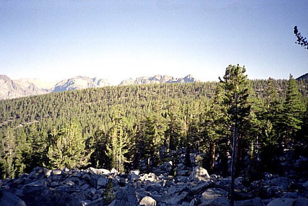
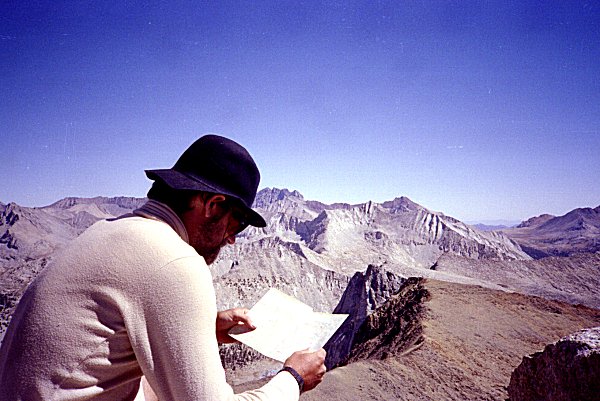
| The second day, as usual, I am extremely tired. I pass close to Mt. Hutchings,
so I take a two our side trip to climb it. It is really not much of a climb as a
stroll along a ridge. |
|
|
Mt. Hutchings |
|
|
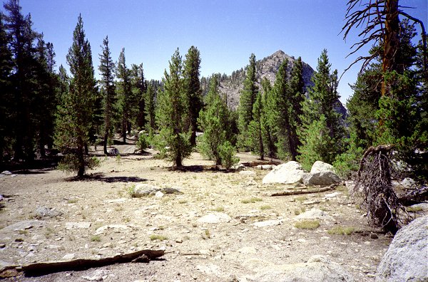
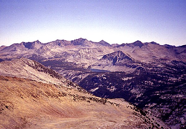
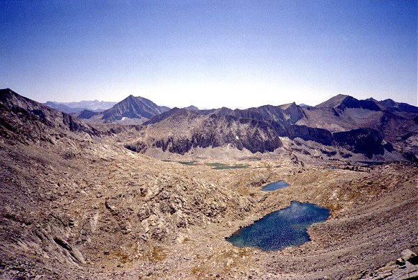
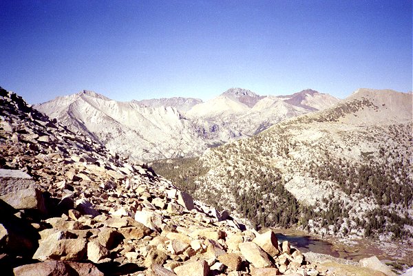
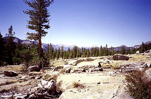
This shows Goat Mountain from Mt. Hutchings. Granite Basin is to the left (out
of the picture). Mt Hutchings also has a spectacular view of the valley of Kings
Canyon. Although the peak is really just a bump on the ridge, it commands a
wonderful view of the valley below. |
| View North from Mt. Hutchings |
|
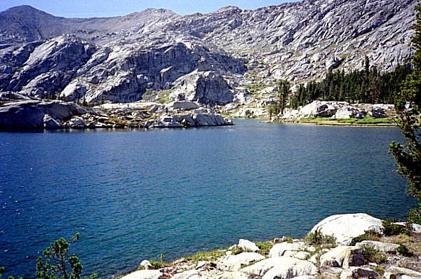
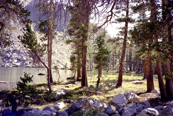
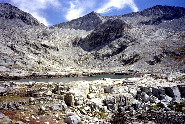
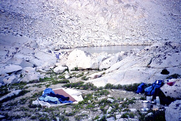
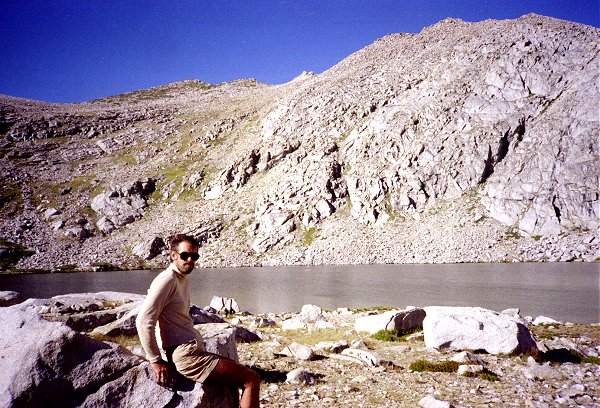
| I continue on into Granite Basin, and camp by one of the lakes there. I
remember being so tired I am almost shaking, but I remind myself that yesterday I got out
of bed at 5:00 AM, suffered jet lag, hiked until midnight (eastern time), and ascended to
10,000 feet. The lack of sleep, exertion, and altitude all take their toll on the
second day. |
|
|
Granite Lake |
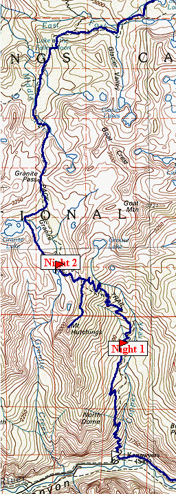
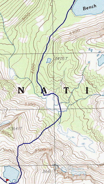
Map 2 -- Marion to Arrow
|
|
The next day I feel better. It helps that the biggest part of the climb is past.
I wander around the basin, and then head back to the trail. Just beyond
Granite Pass, I encounter a crew working on the trail. They are just finishing the
season -- this being September. I have never been hiking this late in the season,
and I am a little concerned about running into cold weather or snow. So far, it has
been sunny and warm. They inform me that it could snow at any time, but that if it
does it will probably melt in a day or two. Let's hope so. By the middle of the
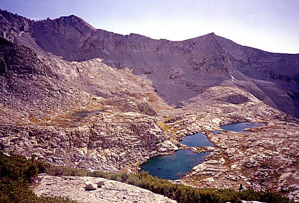
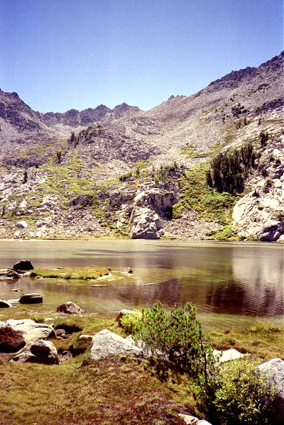
morning I reach State Lakes. |
State Lakes |
|
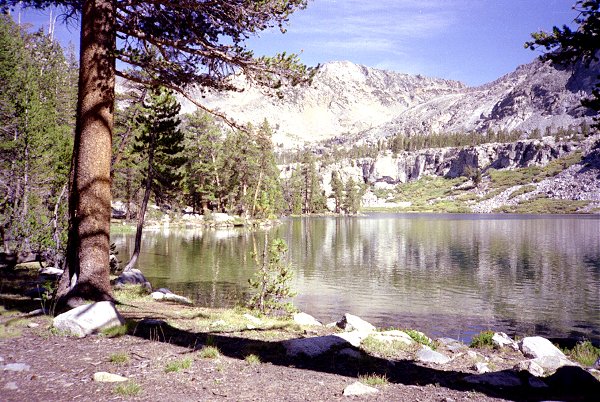
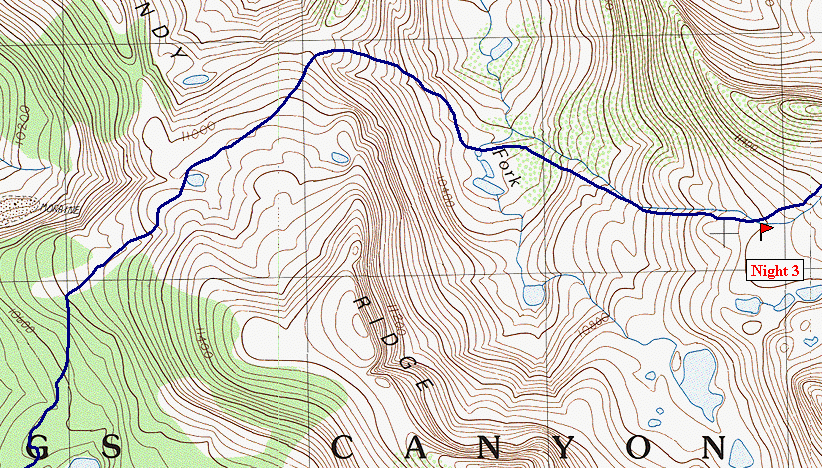
| The last place before leaving the trail is Horseshoe Lakes. |
|
|
Horseshoe Lakes |
|
|
From Horseshoe Lakes, the route leads up this forested ridge, to the right. I
thought that the tree cover would make it difficult to find my way. I am used to
hiking in open territory, where I can see and navigate by landmarks. Actually, it
turned out that I could see well enough that it was not a problem. |
Windy Ridge |
|
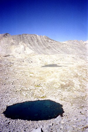
| As I ascended Windy Ridge I came across some small lakes formed, like this one, from
terminal moraines of receding glaciers. Cirque Crest is in the background. |
|
|
Windy Ridge Route |
|
|
The route passes between Cirque Crest above and Cartridge Creek below. This is
the lake just west of the South Fork of Cartridge Creek. |
Windy Ridge Route |
|
Windy Ridge Route
| This tarn is the headwaters of the South Fork of Cartridge Creek. Behind it is
Cirque Crest. |
|
|
South Fork Cartridge Creek |
|
|
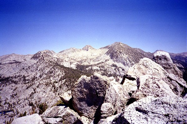
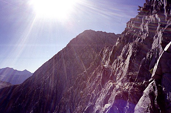
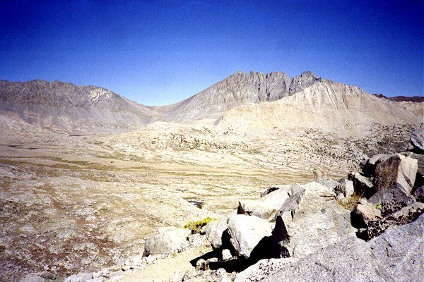
.Travelling beneath the crest, toward Marion Peak, the route goes higher and higher,
approaching the ridgeline. The feeling of being "up in the air" is
invigorating, tension provoking. I spent the night up in this high, cold,
desolate area. I wonder how many hikers pass this way every season. I have not
seen anyone since I passed the trail crew near Granite Pass. |
Cirque Ridge |
|
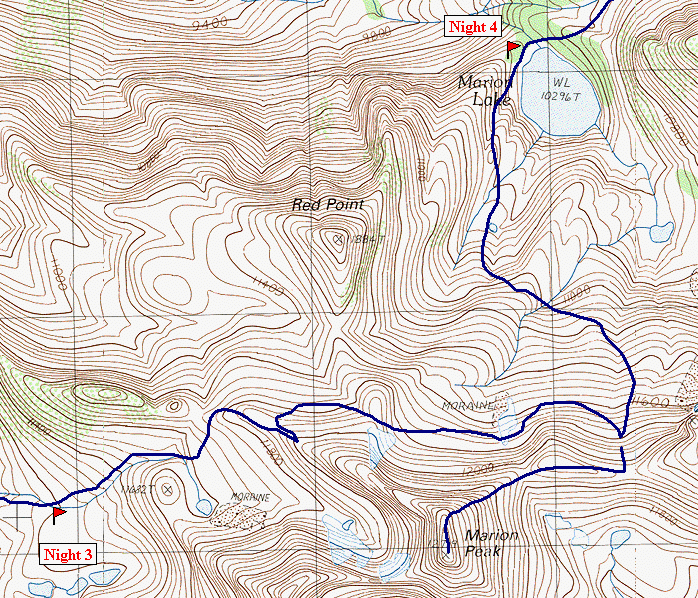
Marion Peak Route
| The next morning, I reached the ridgeline, the one on which Marion Peak sits. I
got the idea that if I could, I would simply follow the ridge to the peak, and then
descend to the lake. This worked out for a while, until I got to a spot on the ridge
that went straight up. I looked at the map, and decided that maybe I could cross
to the other side of the peak without losing too much altitude, and attempt the peak from
the other side.
This shows the peak from the closest I could get on the west ridge. |
|
|
Marion Peak |
|
|
I tried to stay as high as possible, working my way beneath Marion Peak, to find a
place I could get back up to the ridge, and then on to the peak. Here the peak is to
my left and behind, and I am looking for a way up the cliffs to the ridge beyond. |
| East Ridge Marion Peak |
|
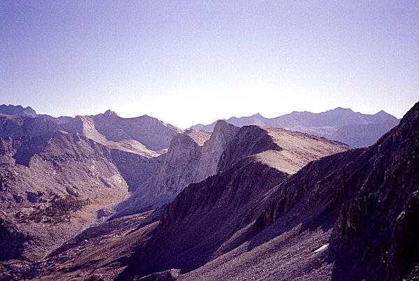
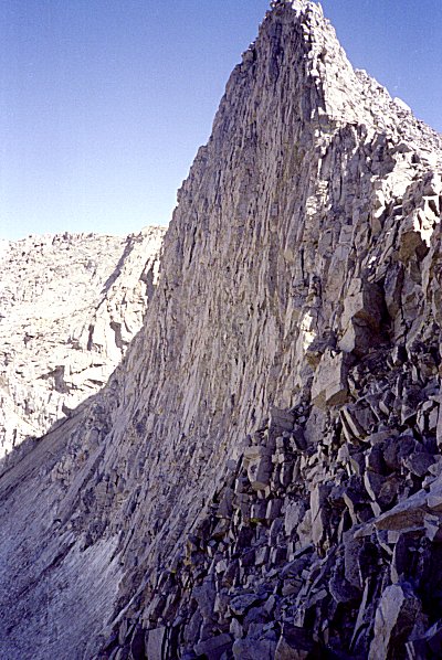
| Eventually I found a way up, and then the route along the ridge to the top was
straightforward. As you can see, Marion Peak is the older, red rock, in contrast to
the lighter granite all around. |
|
|
East from Marion Peak |
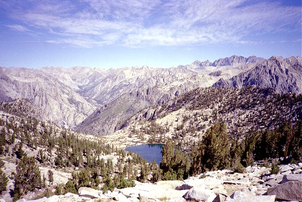
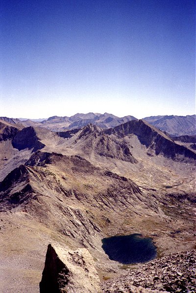
| This shows Bench Lake, which is on the other side of the South Fork of the Kings
River. In other words, there is a deep canyon between here and the lake, only a
little of which is shown in the picture. Just behind Bench Lake is Mt. Ickes, and
on the horizon are the peaks surrounding Gardiner Basin. Arrow Peak, where I am
heading later, is to the right of Mt. Ickes, off the picture. I plan to leave the
trail at Bench Lake, travelling into the basin to its right, so I spend some time studying
the terrain from this high vantage point. |
|
|
Bench Lake from Marion Peak |
|
|
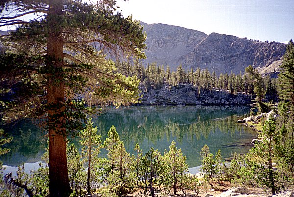
Finally, I descend the ridge I came up, and make my way down to Marion Lake. I
meet up with the party that I last saw at Lower Tent Meadow, who had come over Goat Peak.
They were surprised that I had been able to climb Marion Peak, and asked about my
route. This picture shows where I crossed from right to left on the talus just below the
highest cliffs, to the notch to the left of the peak. The route down from there was
less challenging than it looks here, the cliffs in the foreground being easily bypassed. |
| Marion Lake and Marion Peak |
|
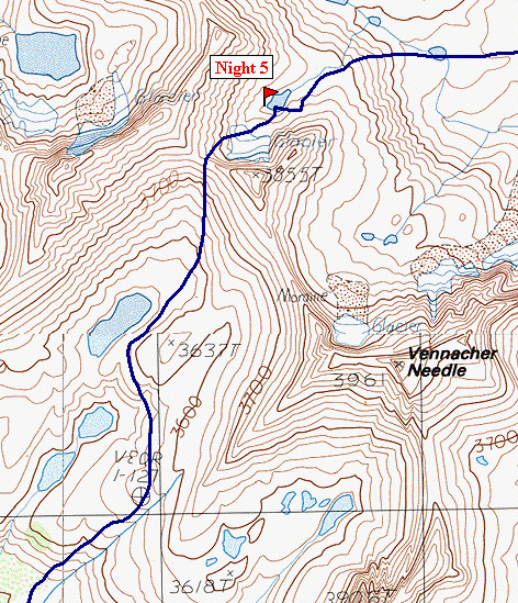
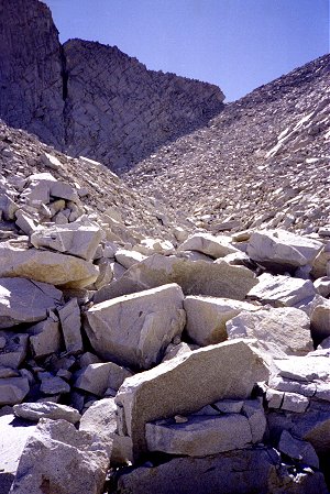
Lake Basin Route
| I had a choice in how to get to Bench Lake. There is a trail shown on the map:
Cartridge Pass Trail. It is an old, unmaintained section of trail, which drops into
the South fork of the Kings. This would have been easier, but I wanted to do some
more exploring. I elected to ascend Lake Basin, cross the ridge near Vennacher
Needle, and join the John Muir Trail near Upper Basin. This shows some of the
lakes in Lake Basin. Cartridge pass crosses the basin and heads over the ridge on the
skyline. This photo was taken on the way up the opposite ridge. This route
took me most of the day to cover, but was not especially difficult. |
|
|
Lake Basin |
|
|
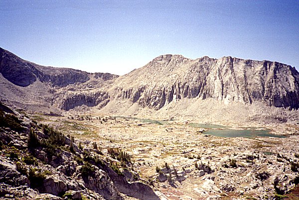
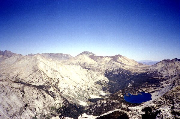
The view from the ridge, back to Lake Basin, was spectacular. This shows the
highest lakes and the route up. The prominent peak on the left is Marion Peak. |
| Lake Basin |
|
| Looking in the other direction, the strange colored rock of Upper Basin was visible.
The mountain in the center is Split Mountain. The John Muir Trail comes
through a pass on the left (Mather pass) and crosses through the valley below. |
|
|
Upper Basin |
|
|
As beautiful as the view of Upper Basin was, I was sorry I had taken this route rather
than the more cautious Cartridge Pass trail. This is what I could see immediately to
my right, and the slope immediately in font, which I would have to descend, looked not
much better. I was unsure whether I had crossed the ridge at the
"correct" point, but I was too tired and it was too late to turn back (or so it
seemed at the time). I cautiously made my way down the steep rocks, ledge by ledge,
fearing a cliff that I could not see. |
| Peak 3855, North of Vennacher Needle |
|
| Once I made it half way the slope got gradually less and less steep, and no impassible
cliffs appeared. I was immensely thankful as I approached the lake at the bottom of
the cliffs, where I made my camp. |
|
|
|
Ridgeline from Halfway Down |
Upper Basin from Halfway Down |
|
|
I made it to a campsite as darkness was falling. My legs were so tired that they
were shaking. But I could relax, because I could see the rest of the way down to the
basin. |
| Campsite North of Vennacher Needle |
|
| The next day, I made my way down to the John Muir Trail. I saw a couple of
people, then another person coming up to Bench Lake. I reached the lake about lunch
time, and headed towards the end of the lake, which is also the end of the trail. I
was aiming to climb into the Arrow Creek drainage by crossing a divide to the left of
Arrow Peak. |
|
|
Bench Lake and Arrow Peak |
Arrow Pass Route
|
|
This is the route into Arrow Creek drainage, known as Arrow Pass. I went around
the lake to the left, ascended diagonally up to about the center of the picture, and then
climbed straight up toward the ridgeline. There were no real obstacles along the way
-- a nice climb. |
| Arrow Pass |
|
| Looking back from Arrow Pass, the lake shown in the previous picture is visible in the
lower right, Mt. Ickes is on the far right with Bench Lake hidden behind it, and Marion
Peak is on the skyline near the center. |
|
|
Mt. Ickes and Marion Peak |
|
|
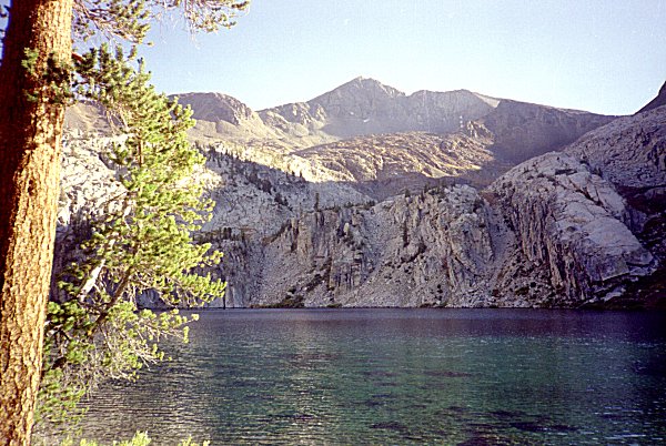
Finally, here is Arrow Pass from the highest lake in Arrow Creek. The descent
was neither very far nor very difficult. I felt truly alone in this area -- there
were no signs of campsites, no trail markers, no sign that anyone had been here before. |
| Arrow Pass |
|
| The next day I decided to climb Arrow Peak. I headed back up to the pass, and
from there I climbed the ridge and the southeast face. This shows the lake by which
I am camped from high up on the face. The peak behind the lake is Pyramid Peak. |
|
|
Arrow Pass and Highest Lake in Arrow Creek |
|
|
From Arrow Peak, Bench Lake came into view again. Behind the lake is Tabose
Pass, an entry route to the John Muir Trail. The deep valley of the Kings is visible
to the left of Bench Lake, making clear how it got its name. Mt. Ruskin is the
light-colored peak across the valley. Marion Peak is farther to the left, not
visible here. |
| Bench Lake |
|
I descended from Arrow Peak and took the rest of the afternoon to explore the upper
reaches of Arrow Canyon. I hiked down the canyon a couple of lakes, and sat down to
contemplate the beauty. By and by I saw a couple of hikers slowly moving up the
canyon. They were without packs, and appeared to be wandering around aimlessly.
They appeared not to see me, so I respected their privacy and just sat quietly on
the rock. In a while, they wandered my way, and came within 10 yards before they
noticed me. They seemed quite startled to see me there, also without a pack.
We exchanged greetings, chatted a little about whether or not there were trout in the
uppermost lake, and finally asked each other about how we had gotten where we were.
This couple told me that Arrow Creek was their favorite place in the Sierras, in the whole
world in fact. They had been coming there together each year for the last eighteen
years, and this was the first time they had ever seen anyone up there. They had come
up from Paradise Valley, as always; they had never climbed Arrow Pass. Since I had
never come up Arrow Creek, they gave me some advice on how to get through a particularly
tough spot near the bottom (keep left). With this we parted -- they were camped
farther down the valley.
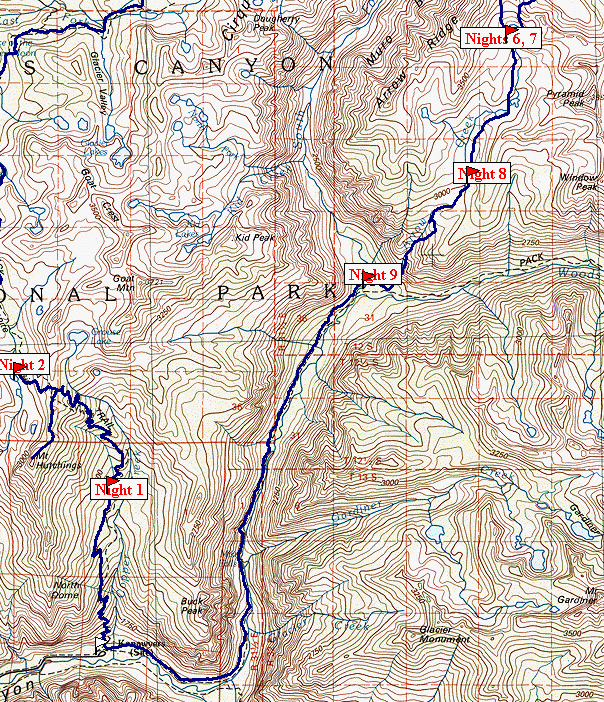
Map 3 -- Arrow Creek to Cedar Grove
| This is the only picture I have of Arrow Creek, other than of the lake at its head.
I spent a long, leisurely day hiking down the canyon, crossing back and forth the
modest stream. I did not see the other couple, but I was not looking for them
either. I made camp about three quarters of the way down, in a pleasant wooded
area near the creek. |
|
|
Arrow Creek |
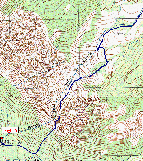 |
The next day I continued down the increasingly steep canyon. At this point the
couple's advice became critically important. It seemed like the canyon floor turned
into cliffs: cliffs above to the left and right, cliffs below in front. I ventured
down a couple of times, only to retreat back up again when the way became impassible.
I kept in mind the advice to go left, but it did not look any better. Then,
miraculously, as I was sitting frustrated on the edge of a cliff I spotted the other
couple, just a tiny speck below. They were only visible for a few moments, but I
could see where they were, so I know where I had to get to. I looped back up even
further, angled even more to the left, and got into a crack that was so full of brush that
my feet could not reach the ground in places. But it lead down, and at long last I
was on the lower slopes, near Woods Creek. I have attempted to capture the critical
maneuver on the map, but use you own judgement if you are tempted to try this. It is
probably a lot safer going up. |
| Arrow Creek Route |
|
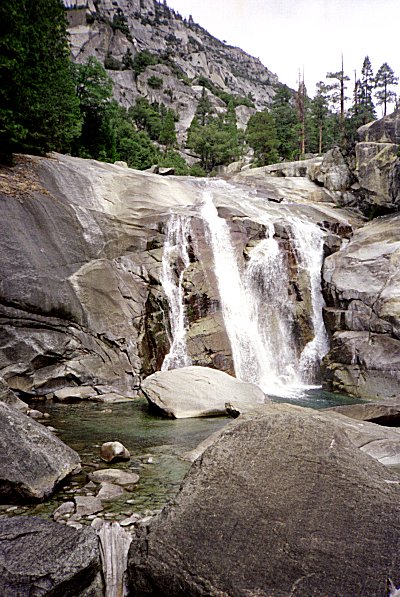
| This was my first trip down Paradise Valley, and the abundance of waterfalls
captivated me. This is Mist Falls, the most spectacular of the falls. I
should have tried harder to get some people in the picture -- the falls are really much
larger than they look here. The water comes crashing down, throwing spray up and
making everything around wet and slippery. |
|
|
Paradise Valley |
|
|
At the bottom of Paradise Valley, where it joins with Bubbs Creek, there are some
strange plants, that look like green sticks. They are jointed, a little like bamboo,
but apparently have no leaves. I have seen them nowhere else in the Sierras. |
Near Junction South Fork Kings
and Bubbs Creek |
|
 Go
back to Charles Hayden's Home Page
Go
back to Charles Hayden's Home Page
cchayden@gmail.com