Trip Report -- Iron Mountain
Note: there are two versions of this page. This one was scanned from negatives,
the other was scanned from prints.
You can judge which is "better." I feel that the images from
negatives are more "accurate."
According to John Robinson, author of Trails of the Angeles, "8007 foot Iron
Mountain is by far the least accessible peak in the San Gabriels. ... No trails approach
its isolated summit, and to climb it you must start miles away and thousands of feet
below." The hike, the most strenuous in the book, is fifteen miles climbing
(and losing) 6000 feet. The challenge inherent in that entry in the trail book
fascinated me, as did the mountain's placement -- the highest point in the front range,
with the best view of the LA basin.
During the years I lived in Los Angeles, I attempted the climb twice (maybe
three times, I am not sure). The first time was very hot and dry.
I saw a couple of rattlesnakes lounging directly on the trail. Observing their
departure, I realized that those long diagonal marks in the dirt I was seeing every few
yards were rattlesnake "footprints." I ran out of water less than one
third of the way up, and was so exhausted that I hardly cared. I turned off and
visited Allison Mine, a fascinating destination in itself.
I vowed to pick cooler weather next time. Unfortunately, when I got a
couple miles in it started to rain. Then came thunder, lightning, and hail.
I got to the same junction, and again decided to head for Allison Mine. This
time I stayed in one of the old mine shacks. Getting back, which involved several
crossings of the rain-swollen San Gabriel River, was one of the most harrowing experiences
I have ever had. This story is recounted
elsewhere.
Now, almost twenty years later, I had a business trip which would give me one free day
in the Los Angeles area. Although there were lots of interesting things I could
do, even lots of interesting hikes I wanted to do, I just had to finish this
first. I could not let Iron Mountain defeat me.
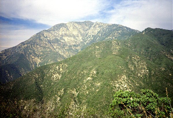
The trail up Iron Mountain starts adjacent to the East Fork of the San Gabriel, climbs
about 1000 feet to a ridge, and then follows the ridge all the way to the summit.
This is the view of the ridge from below, in the canyon of the San Gabriel, before the sun
rose over it.
Since my rule of thumb, based on mileage and elevation gain, suggested a trip of 15 hours,
I was determined to start early. I had to leave my hotel downtown at 4:00 AM to
escape the road closures due to the LA marathon, being run on the same day. I
arrived at the trail head just as it was getting light enough to see where I was
going. |
|
|
Pre-sunrise Over Iron Mountain Ridge |
| As soon as I got to the ridge, I could see the rest of the route. It was hard
from the bottom to know if this was the top, or only a bump on the ridge hiding the
real peak behind. I believe the highest point on this picture is almost the
peak, but not quite. |
|
|
First View of Iron Mountain |
|
|
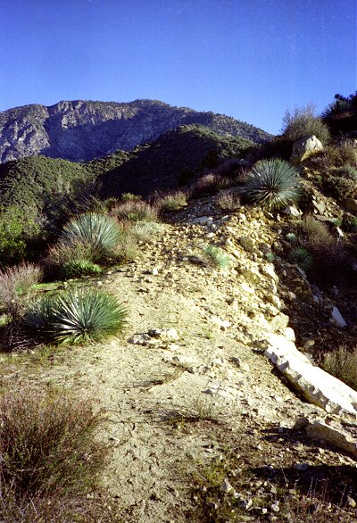
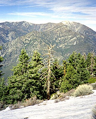
At the lower elevations, the vegetation was brushy, as shown in the first photo.
Spiny yucca plants were abundant in the middle elevations, between 3000 and 5000
feet. Chaparral dominates from 4000 and 6000 feet, and then the vegetation gives way
to sparse forest. You can see most of this variety here, which also shows the trail
along the ridge. The chaparral apparently tortured Robinson when he climbed this
peak, but I found that hikers had established enough of a path that I rarely had
to fight my way through brush. this was a pleasant surprise, and permitted me to
keep up a rapid pace the whole way. |
The Ridge Trail |
|
| Allison Gulch, a major side canyon to the San Gabriel on the slopes of Iron Mountain,
is home to the Allison Mine. On my previous trips to the area I have carried
camping equipment, planning to stay overnight at the mine after climbing the peak.
The mine was fascinating (the last time I visited) and well worth a trip for its own
sake, but the effort of hauling my backpack up the steep trail made it too tiring for me
so this time I planned the hike as a day trip and bypassed the mine. |
|
|
Allison Gulch |
|
|
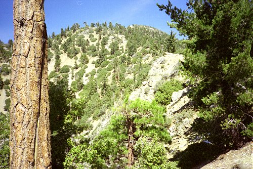
The transition from brush to forest was welcome, although the trail did not get
notably less steep. This shows the ridge in the upper elevations. The high
point on the left is probably the peak that can be seen from the lower elevations, whereas
the peak in the center, considerably farther back and higher, is the true peak. |
Upper Slopes -- Peak at Right |
|
The San Gabriels consist of a "front range" directly facing the Los
Angeles basin, with peaks like Mt. Wilson and Iron Mountain, ranging from 5000 to 8000
feet. Farther back, in a second tier, are the highest peaks like Mt. Baden-Powell
(shown here) and Mt. Baldy (next).
Both these peaks are higher than Iron Mountain, considerably easier to reach on foot, and
among the most popular hiking destinations in the area. Mt. Baden-Powell is only
four miles from the trailhead, Mt. Baldy three and a half from the restaurant at the top
of the ski lift. Furthermore, the view of the basin and the coast from either of
these mountains is obstructed by the mountains of the front range. |
|
|
Mt Baden-Powell |
|
|
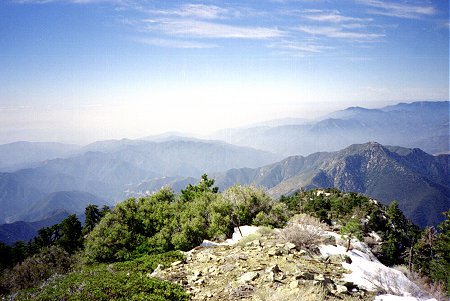
The view from Iron Mountain, unobscured by mountains, superb in theory, still depends
on air conditions. The day I climbed, there was a hazy cloud cover over the
city, so I could not see much. This view shows the ridge I ascended, and the
foothills beyond. LA is out there in the haze somewhere.
I was surprised when I arrived at the peak. Based on my predictions, I
thought I had another hour to go when I arrived at the top. The ascent
took me only five hours. I was not even that tired. I attribute this to
being well hydrated all the way, carrying almost no equipment other than water and a
camera, and to wearing hybrid trail-running shoes instead of my hiking boots.
I brought four quarts of water, eight pounds. Determined to avoid dehydration,
I drank freely until it was gone (about halfway back). Even so, it was not near
enough. As soon as I got back, I immediately drank two more quarts, and
was thirsty still. |
LA Basin from Iron Mountain |
|
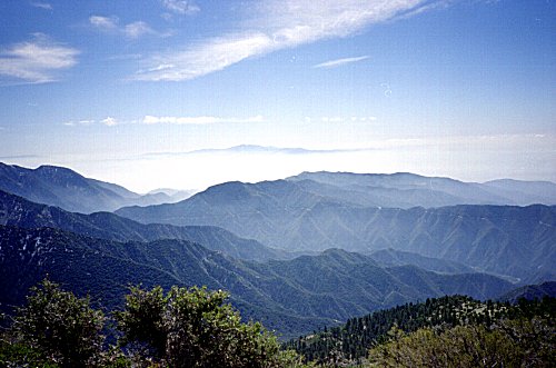
| This view of the Eastern San Gabriel foothills shows a peak, rising above the clouds
in the distance. Jason at CSU Fullerton tells me it is Saddleback Mountain (Santiago
Peak), in the Santa Ana Mountains, 40 miles away. . |
|
|
Eastern San Gabriel Foothills |
|
|
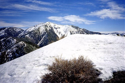
Mt Baldy, also known as Mt. San Antonio, is the highest peak in the San Gabriel
Range. Like Mt. Baden-Powell, it sits back behind foothills, and does not command a
view of the LA Basin. This view shows Mt. Baldy with the peak of Iron Mountain
in the foreground. It appears that it would be possible to descend along the
ridge to the left, and continue on to Mt Baldy. This would be an interesting hike
for "next time." |
Mt. Baldy |
|
| Descending from the peak was harder than I expected. The "trail" was
exceptionally steep in many places. In many places I slid back on the loose
rock, and had to grab onto rocks or bushes to scramble up. It proved to be much
harder on my legs going down than going up, although less work aerobically. Even
though I was in a hurry to get back, my time to get back was barely faster than the
time to ascend. This view, of the San Gabriel River, was taken just after leaving
the ridge crest. The sun, getting low in the sky, shines off the river far
below.
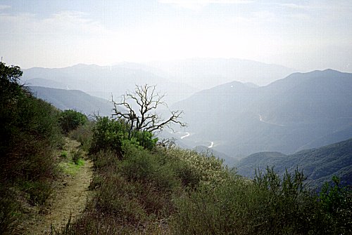
The road, visible on the right, has an interesting history. It was apparently
intended as a major artery crossing the San Gabriels. Upstream several miles there
is an impressive concrete bridge spanning the river, and a tunnel through the
hillside. Apparently a flood washed out part of the road before it was completed,
because it does not even make it to the bridge. |
|
|
East Fork from Iron Mountain Trail |
Although I did not get the great views that are sometimes possible from Iron
Mountain, I achieved my long-time goal more easily than I expected. I saw fresh
footprints, but did not see any other hikers on the trail all day. When
I checked the peak register, I saw to my surprise and delight, that the last
person to sign the register, three weeks earlier, was someone I knew, from Fair Haven
! A student at Caltech, he is apparently using his weekends to climb in the nearby
mountains, just as I did. He tells me that when he was there, the air was sparkling
clear, and he could see half of Southern California.
cchayden@gmail.com
 Go
back to Charles Hayden's Home Page
Go
back to Charles Hayden's Home Page