|
| Rusk, Hunter, Southwest Hunter, and West Kill |
| Get TPO file |
| Get TPG file |
|
||||
| Drove up to Spruceton Rd, arriving about 8:00 PM. Marvelous sunsets. Had
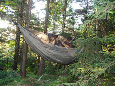
hoped to get up earlier, but was delayed by work duties. Had everything packed and ready to go, so it only took 10 minutes to get going. In the waning light, followed the carriage path up toward Rusk. When the trail took a sharp right, my intuition told me to check the GPS. Sure enough, time to head off. By this time it was pretty dark, so I switched to headlamp, wading through waist-high nettles, and steep, slippery slopes. After ten minutes, I started looking for a place to camp. The hammock is wonderful! I recommend it without reservation. I set it up on a very steep slope, just a tiny flat spot, but two trees apropriately spaced. Got set up and into bed in ten minutes, slept great all night. |
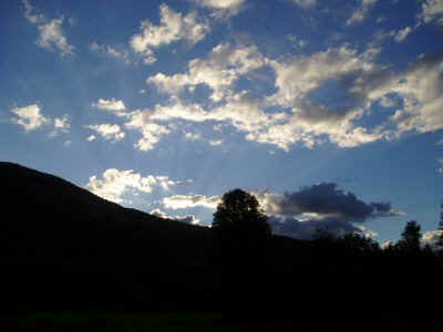 |
| Skies in West Kill |
.
 |
Up early, grabbed a bite to eat, and off in less than 20 minutes. Head up the
stream bed, which quickly becomes dry. It is like a staircase, but very steep.
At the fork in the streambed, angle to the left, toward Ox Hollow. Early on, I pulled a calf muscle. I consider turning back, but decide to go on a little and see how it does. Every step is painful, and I can't take must of a step with one leg, but the other works OK so I go on. Eventually things level out, and I reach the ridge at the first col east of Rusk. From there, I head up towards Rusk, finding faint, and increasingly more distinct use paths. The summit is distinct, the canister easy to locate .
|
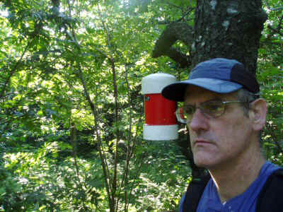
| Rusk Canister |
| Heading back down, I manage to follow the path all the way to where I joined the
ridge, and then the paths suddenly give out. The ridge is wide and indistinct, so I have
to be very careful to stay on it (rather than going off on some side spur). The ridge
angles around a bit. I see some helpful paint blazes where private property intersets the
ridge, a sign to adjust course. Heading down and down, eventually I reach the trail
I had left the night before. This is a very wide trail, really a carriage path, used by horese as well as hikers. There is a nice spring partway up, where I fill up my water and have a snack. |
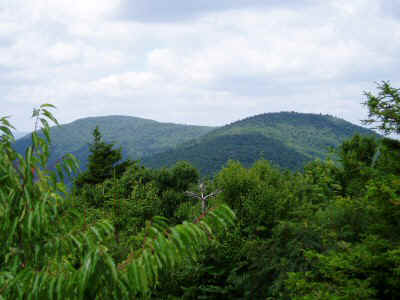 |
| View of Rusk and Ridge from East Ridge |
 |
Although the trail is very steep in places, I make quick progress. Eventually it
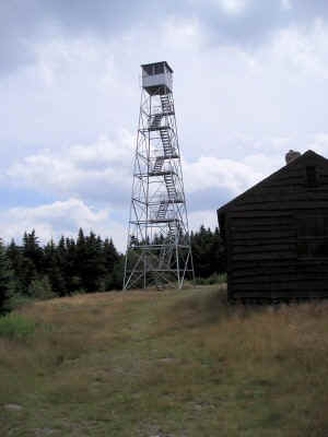
flattens out, and soon the Hunter fire tower appears. I walked up the tower stairs, but I could not get inside. The breeze up there is pretty stiff. I took some photos and headed back down. The view is really impressive. I encountered two parties of two near the summit, but no one was at any of the lean-tos that I passed. |
| Hunter Fire Tower |
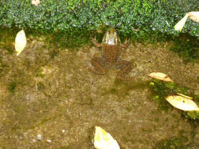
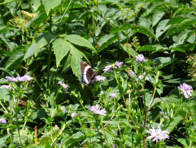
| There is a spring near where I was planning to leave the trail for Southwest Hunter.
I again filled all water bottles ready for a long spell without water. The meadow was chest high with wildflowers and butterflies. The spring was home to several frogs. It was a beautiful spot, but I was anxious to find Southwest Hunter. I had read accounts of parties (experienced hikers no less) who had tried three or four times before finding the canister on Southwest Hunter. I had neglected to review their trip reports, but I was hoping for the best. |
 |
| Spring at SW Hunter Junction |
| I had marked a GPS waypoint where I intended to turn off toward SW Hunter. I found a
side trail at exactly that spot. It was going left, whereas I was looking for
something going right. I stared at the map until I realized that I was confused, and
that the trail should be on the left after all. So I followed the trail.
Unfortunately, this trail lead to a camping spot, then petered out I continued on, hoping that I was heading the right direction. After 15 minutes of thrashing through unbleasant brush and trees, I came upon a distinct trail going more or less the right direction. Following it, I noticed that it was amazingly straight and also flat. then I recalled talk of a railbed. I must be on the railbed. I kept going, enjoying the pleasant walking, even if it was not really on the ridge. Suddenly there was a pile of rocks and a distinct trail going left, up the slope. I followed another very well trodden path, and it led right up, straight to the canister! Looking at the topo map, there is actually a very small closed contour at 3740 feet, perhaps only 100 feet across. The canister is, in fact, within this contour. |
 |
| Meadow at SW Hunter Junction |
 |
Returning the same way I came, I followed the railbed path to the junction with the
official trail. I wanted to see where I should have turned off. The junction is really obvious, and I had walked right past it. It is only about 50 years from where I turned off toward the campsite. . |
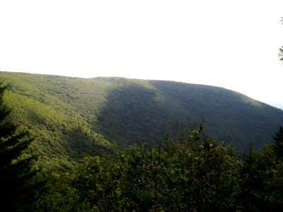
| Southwest Hunter from Devil's Path Overlook |
| With three peaks already unde my belt, it is only 4 PM. I still have four hours of
daylight. I had thought of camping near SW Hunter, but I push on, descending all the way back down to West Kill Falls near Spruceton Road. I am tempted to go back to the car and stay there, but it is still only 5 PM, so I head back up toward West Kill. |
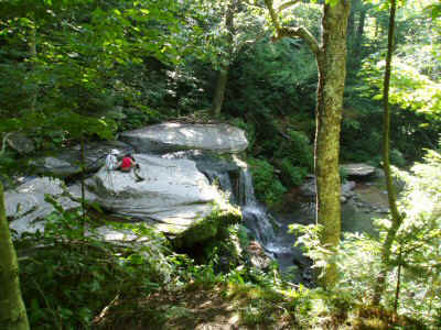 . |
| West Kill Falls |
 |
Ten hours of hiking have taken their toll, and the trail is actually really steep, so
I am going pretty slow. I want to fill up at the spring shown on the map, and then make
camp as quickly as possible afterwards. I pass lots of dried streambeds, but no spring. Finally, I find a tiny trickle, just barely enough to get my filter into, and filled up my water again. Now ready to camp, I keep my eyes open for a good spot, but with daylight I am a lot more picky. I continue to trudge up and up, beginning to worry that I would pass the 3500 foot mark. When it looked like I was nearing the ridge top, I veered to the left looking for an opening in the trees where I can set up. I found a delightful little spot, facing the east, in a field of clover. I had a quick bite to eat and dived into bed at 7:30. After 12 hours of hiking I did not have too much trouble falling asleep. |
| Campsite on West Kill Ridge |
It was cool at night, enough so that I had to zip the sleeping bag up all the way. I love that cocoon feeling in the hammock, where you just feel like you are floating.
I caught the early morning sun, and enjoyed being lazy for half an hour before getting up. My calf muscle, although hurting to some degree almost every step of the way yesterday, got better overnight. It must have appreciated the rest.
One thing about going light -- it is also a lot faster because I don't have as much to pack up. Time from getting out of the sleeping bag to departure -- 10 minutes.
Heading back to the trail, I come across an informal trail, leading to a fire ring, and then a couple of campsites. These are too close to the trail to be really legal, but are nice campsites nevertheless. They are on a little flat place beneath a cliff. I would have run into these if I had continued on the trail another 100 yards. I am glad I camped where I did. The 3500 foot sign is right next to the side trail to the campsite.
Thanks to the marathon day yesterday, there was only a couple hundred feet more climbing left to do. I enjoyed walking along the ridge. There was sill some mornining haze, so the views at the overlook were not as spectaculare as I had hoped. I had a little breakfast there, and continued on to the peak.
There is a little pile of rocks and a sign at the peak, a nice touch.
I could have turned around and retraced my steps to the car. It was a little longer to continue to the western trailhead, and then I would be a few miles down the road from the car. But I decided that since it was Saturday, there would be plenty of hikers and I would be able to get a ride back.
The walk was pleasant, typical ridge hiking with some impressive cliffs along the way. I passed the marsh that I had camped next to before, and I got to see the trail that I had previously traveled in the dark.
However, I did not pass anyone, nor did anyone offer me a ride back, so I wound up walking all the way back to the car. Oh well, I guess it was worth it.
Four peaks in a day and a half of hiking. I am closing in on the 3500s. I have five more peaks, plus two winter peaks that I have to repeat. It won't be long now. Actually I am beginning to think about exploring some other places not on the 3500 list. But enough of that -- I need to finish.
Measured locations for peaks, campsites, and junctions. The coordinates given in the Shemella and Marchant lists (referenced above) are apparently taken from maps, not from GPS readings, and do not exactly agree with the readings I have taken. These coordinates represent the values I measured.
| Campsite 1 | N42 11.622 W74 16.065 |
| Rusk | N42 12.060 W74 16.652 |
| SW Hunter | N42 09.739 W74 14.615 |
| SW Hunter Turn Off | N42 09.856 W74 14.614 |
| SW Hunter Trail Junction | N42 09.902 W74 14.128 |
| Campsite 2 | N42 10.003 W74 16.346 |
| West Kill | N42 10.080 W74 17.362 |