|
|
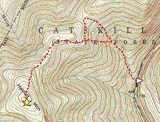
|||||||
 |
Only one peak away from the 39 required peaks, I take advantage of a month-long rainy
spell to get in the last peak, Halcott. I was partway up the slopes with my Irish
Setter, Rosie, when she simply sat down and refused to go any further. So I leave
her at home this time. The weather has been strange this year, very wet. The trees
are usually bare by the end of October, but most have leaves and many are still green.
But it snowed earlier in the week, and there was patchy snow on the ground at the
Halcott trailhead east of the summit. I had gotten up very early, and driven through the
darkness to get to the trailhead just at down. I did not want there to be any
problem getting up and down by dark. As I passed the landmarks familiar from last
try, the snow cover become continuous, then it started getting slowly deeper and deeper.
The weather was cloudy and windy, but not terribly cold, and I was keeping plenty
warm going up the steep slopes. The stinging nettles, which are probably why Rosie
refused to go on, were now buried beneath the snow. The most direct ascent to the saddle ascends slopes that are so steep that they are very difficult to walk up. Last time I attacked these directly, but this time I worked my war around to the right, where it is more moderate. This worked better, but I went a little too high, and had to decent a bit when cutting back to the left to get to the saddle. |
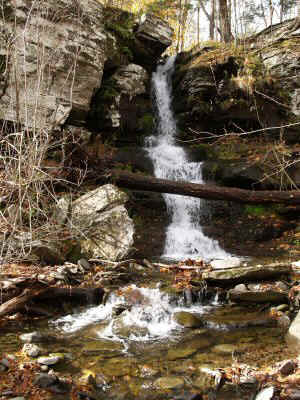
| Waterfall at Halcott Trailhead |
| Navigation was tricky, because the clouds made it impossible to see the sun and the
trees, still covered with leaves, were also covered with lots of snow, and this blocked
all views of the surrounding terrain. I relied on my compass and GPS, because it was
not really apparent when I was at the ridgeline, and where the peak was from there. Coming up the slopes, I see some tracks in the snow. They look like footsteps: about the size and configuration a hiker would make. I think, maybe they lead to the peak, and I will have an easy time of it. I look down at the steps themselves. Whoever it is must have pretty short feet. Then I look more closely -- they must be barefoot, for I can see the toes. Finally, I see there are claws on the toes -- it must be a bear. I never knew that bear tracks would be so regular -- I have been happily stepping in each one for a quarter mile. After a while, they seemed to be going away from the peak, so I resumed my trail-breaking pace. By the time I got to the ridge, the snow was about a foot deep, and in drifts it was up to my knees. Even walking on the flat was as tiring as climbing. The climbing was actually pleasant because the snow was now firm enough to kick steps. Lower down it was just a slippery layer over wet rocks and leaves. The trees are beautiful, encased in snow. The slightest touch, and they dump it all on the ground. |
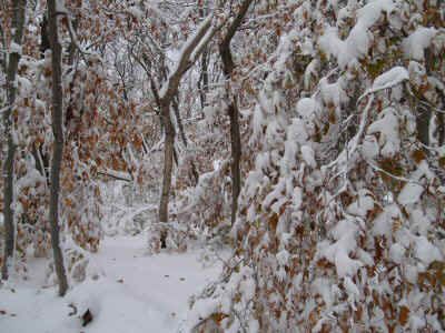 |
| Snow on Trees |
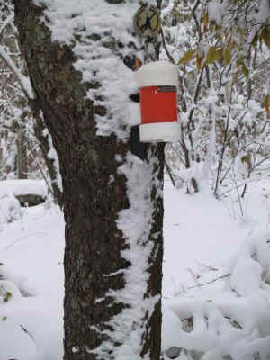 |
Once I reached the summit area, I started circling around, looking for the canisters.
I had trouble determining from the slope where the high point lay, and I also had
trouble spotting the canister itself. After wandering for 10 minutes, I discovered another
set of tracks, which led about 30 feet, right to the canister. The only tracks I
have seen all day, the log book reveals they were from a visitor yesterday. It took three hours to get up here. I stop and have a snack, but when I stop moving I get cold quickly. The map shows a viewpoint near the peak, but it is a ways off, and moving at all is so hard in this snow, so I decided to skip the viewpoint today. |
| Halcott Canister |
| I took some photos, and headed back down. Following my tracks, it is a lot easier going down. I left my tracks at one point to avoid going up hill, but I did manage to rejoin them a little farther down. When I am almost down, I get sucked into the ravine near the stream. This happened last time too. I thought I had learned my lesson last time. I picked my way down the steep rocks, fallen branches, and rushing water to the top of the falls. Whoopee! Done with the list! | 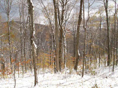 |
| Clearing Skies |
Now comes the crucial test. Without the list to motivate me, do I continue coming to the Catskills to hike? I am cold and wet, and I am tempted to just drive home and send in my form. Instead, I decide to stay overnight and climb something else tomorrow.
I was considering spending the night in a lean-to, perhaps the one just off the Wittenberg trail. I head over to the Woodland Valley trailhead, but there are a dozen cars in the trailhead parking lot. If the shelter is full, I am not sure I want to camp out in the snow. Since it is still early afternoon, I decide to hang around the car in the sun and out of the wind, and see if a bunch of day hikers return. A couple of hours go by, and no one comes back. In fact, some more people park, load up backpacks, and head on up the trail.
So I drive back to Phoenicia, have dinner, and head up to Peekamoose instead. I want to see if I can find the plane crash in on Friday. Now dark, I drive to the Kanape Brook parking area, which is empty. I decide it would be simpler just to sleep in the back of the car, which was really cozy. Outside, I could hear lots of wind. I fell asleep quickly, and slept twelve hours.
 |
Up again at down, I headed back down to Moon Haw Road. I had intended to park at
the Friedel parking area, but I was put off by the "private property" sign, and
decided to look further up the road. At the end of the road, there was a parking
area with half a dozen cars, so I decided to start there. The weather was clear and sunny, with a mild breeze. I quickly shed my gloves, then unzipped my jacket. I climbed upward on a series of old logging roads, alternating between ones that meandered lazily upward with ones that headed straight up the side of the mountain. Eventually, I think I reached the highest road, so I took off up the slope on my own. |
| Old Road |
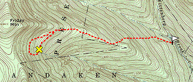
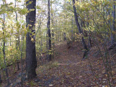
| Before long, I hit the ridge, and not long after that I detected faint signs of the path. There were a lot more leaves down here, and that covered many of the signs of the path. I followed the ridge, only occasionally seeing the path, but I was not too worried. After ascending a couple cliffs, both the path and the route to the crash required leaving the ridge to the left. I passed a pile of rocks, and continued to follow the faint trail up toward the saddle between Balsam Cap and Friday |  |
| Cornell |
 |
I had the coordinates of the crash site in my GPS, and I was watching the bearing from time to time. My plan was to get as close as possible on the path, then make a beeline for the site. I followed this plan, although it took me considerably above the crash site. When I finally decided to leave the trail, I was almost directly uphill from the site. I made my way down, looking for any signs of the crash. It was not until I was within 150 feet of the crash that I spotted it. This would be really hard to find without the coordinates. |
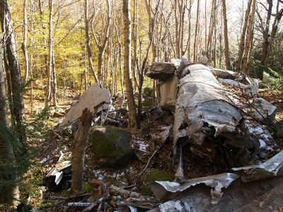
| Crash Site Overview |
| The debris was quite confusing: it was not clear what parts of the plane were what, and how they were originally connected. | 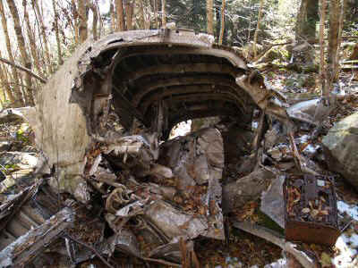 |
| Main Fuselage |
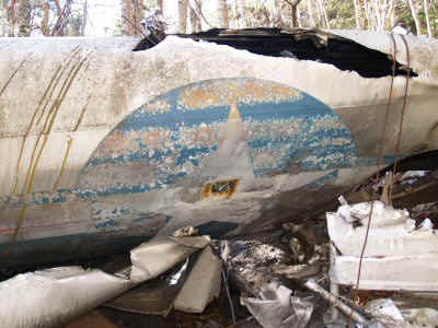 |
In particular, it was unclear what happened to the wings. |
| Air Force Emblem |
| This is the nose. | 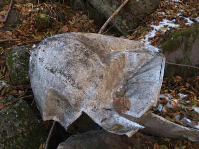 |
| Nose |
 |
I spent half an hour looking around before heading back. This time I wanted to contour around and meet the trail lower down. I rejoined the trail right at the prominent pile of rocks, suggesting that someone has used it as a mark for where to leave the trail for the crash site. |
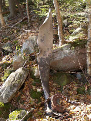
| Propeller |
| As I was leaving, I could hear another party above me. I scampered away as they came down, not wanting to spoil the wilderness experience for them. I saw them pass by just a stone's throw away, but they never suspected I was there. It looks like they were headed to the crash site as well. Someone sent me email last week about visiting the site, probably because they say my web page. Maybe I should take the GPS coordinates of the rashes off in the interest of preserving them as they are. | 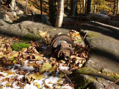 |
| Gears |
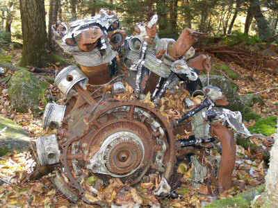 |
There were two huge engines. It is hard to tell, but this is about 5 feet across. |
| Engine |
| Most of the pistons were recognizably intact, but a few of them appeared to have melted. There must have been a fire. | 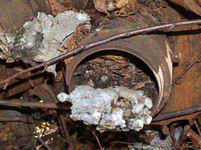 |
| Melted Piston |
There was very little snow -- the snow line was just at the altitude of the crash. It is strange that there was so much more just a few miles farther west. I had a pleasant descent in the warming sunlight. When I got back to the car, the same cars were at the parking area. I wonder where they were. Maybe there was a big party crossing from Woodland Valley over to Friday and down to Moon Haw Road.
| Halcott | N42 10.794 | W74 26.248 |
| Crash Site | N41 59.019 | W74 21.359 |